
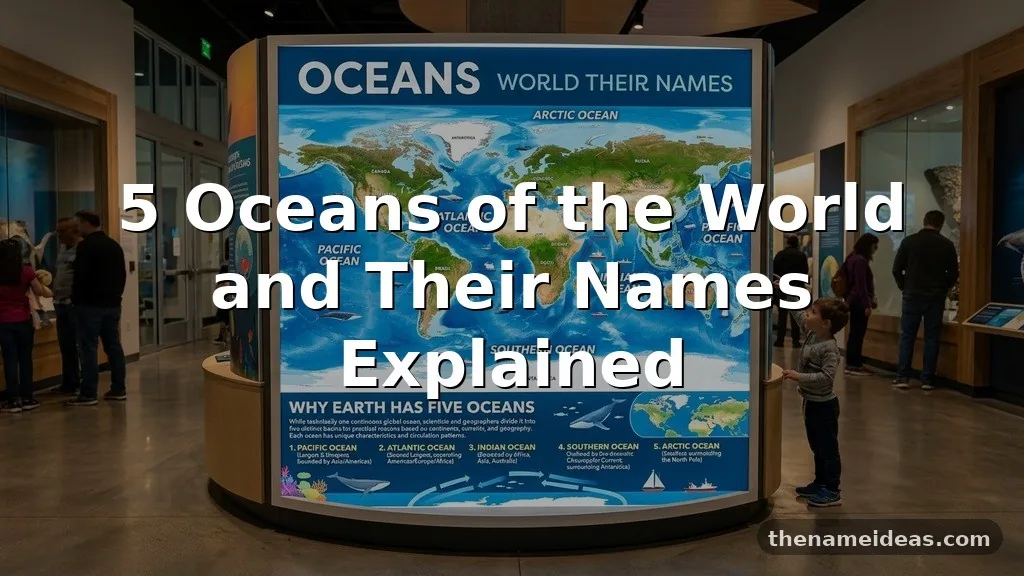
For anyone studying the Oceans of the World and Their Names, the key fact is simple: Earth has five officially recognized oceans—the Pacific, Atlantic, Indian, Southern, and Arctic. They form one connected body of salt water, but each has distinct boundaries, currents, climates, ecosystems, and historical importance.
Knowing their names in order of size makes geography easier, while understanding their locations explains weather, trade, wildlife, and polar conditions. The details also clarify why some sources mention seven oceans instead of five and why the Southern Ocean is now commonly included in modern maps.
The Five Ocean Names at a Glance
The five-ocean model divides the global ocean into named regions. These boundaries are useful for study and mapping, although the water itself remains connected across basins and around continents.
- Pacific Ocean
- Atlantic Ocean
- Indian Ocean
- Southern Ocean
- Arctic Ocean
The Pacific Ocean is the largest and deepest. The Atlantic Ocean follows in area, while the Indian Ocean ranks third. The Southern Ocean circles Antarctica, and the Arctic Ocean occupies the high-latitude waters around the North Pole.
| Rank by approximate area | Ocean | Approximate area | Primary location |
|---|---|---|---|
| 1 | Pacific Ocean | 165.25 million km² | Between Asia, Australia, and the Americas |
| 2 | Atlantic Ocean | 106.46 million km² | Between the Americas, Europe, and Africa |
| 3 | Indian Ocean | 70.56 million km² | Between Africa, Asia, and Australia |
| 4 | Southern Ocean | 21.96 million km² | Encircling Antarctica |
| 5 | Arctic Ocean | 15.56 million km² | Around the Arctic region |
Area figures vary slightly according to the source and the boundaries used, especially around the Southern Ocean. For a broader scientific reference, the National Ocean Service explanation of the five oceans provides a reliable overview of the modern classification.
Why Earth Has Five Oceans
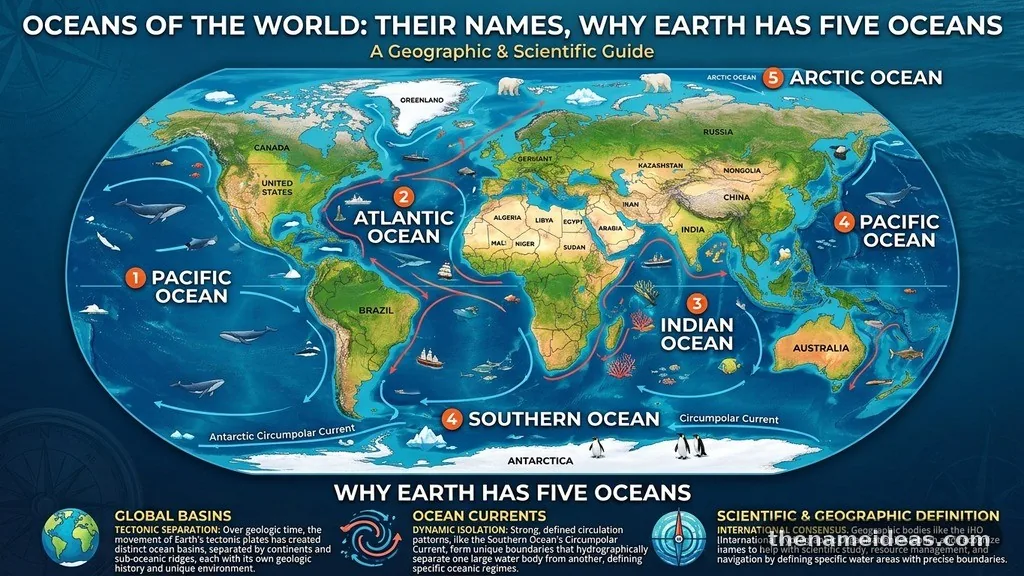
Earth has one connected global ocean, but geographers divide it into five named oceans to describe enormous regions more precisely. Continents, island chains, underwater ridges, latitude, and major current systems help establish these regional boundaries.
This arrangement is similar to dividing a large landmass into countries or regions. The borders are meaningful for geography and administration, yet water continues moving across them through currents, tides, mixing, and atmospheric circulation.
The five-ocean model is especially common in modern schools, atlases, scientific education, and international geography. Older materials may group the Southern Ocean with the Atlantic, Pacific, and Indian oceans, producing a four-ocean model.
The Southern Ocean also explains why different maps can appear to disagree. Its recognition as a separate ocean became more widely accepted during the late twentieth and early twenty-first centuries, although its exact northern boundary has not always been treated identically by every institution.
Ocean boundaries are not simply lines drawn on a classroom map. They reflect physical patterns, including the way cold Antarctic water flows northward and meets warmer waters from lower latitudes.
The Pacific Ocean
The Pacific Ocean is the largest of the five oceans and covers more surface area than all of Earth’s land combined. It stretches from the Arctic region in the north to the Southern Ocean in the south, with Asia and Australia on its western side and North and South America to the east.
Its name comes from the Latin word pacificus, meaning peaceful. Portuguese explorer Ferdinand Magellan used a related expression after encountering relatively calm conditions during part of his voyage, but the Pacific can also produce enormous waves, powerful storms, and dangerous earthquakes.
The Pacific contains the deepest known point in the world’s oceans: the Challenger Deep in the Mariana Trench. Its depth is generally reported at roughly 11,000 meters, although measurements vary because the seafloor is difficult to survey precisely.
A major geological feature of the Pacific is the Ring of Fire. This broad zone around the ocean’s edges contains many active volcanoes and earthquake-prone boundaries because several tectonic plates meet there.
The ocean’s western and central regions contain thousands of islands, including large island groups in Polynesia, Micronesia, and Melanesia. These communities have long histories of navigation, trade, settlement, and cultural exchange across distances that once seemed impossible to cross.
The Pacific also influences weather far beyond its shores. Changes in sea-surface temperatures associated with El Niño and La Niña can affect rainfall, drought, storms, fisheries, and agricultural conditions across multiple continents.
Its size makes the Pacific central to global shipping and climate research. It absorbs heat from the atmosphere, supports major fisheries, and contains ecosystems ranging from shallow coral reefs to deep trenches where sunlight never reaches.
The Atlantic Ocean
The Atlantic Ocean is the second-largest ocean and forms a broad, roughly S-shaped basin between the Americas on one side and Europe and Africa on the other. It connects northward with the Arctic Ocean and southward with the Southern Ocean.
The name Atlantic is linked to the ancient Greek idea of the Sea of Atlas. In classical geography, the term referred to waters beyond the Pillars of Hercules, the traditional name for the Strait of Gibraltar.
The Atlantic has played an outsized role in human history. It became a major route for exploration, colonization, migration, commerce, and cultural exchange, while also being associated with the transatlantic slave trade and the forced movement of millions of Africans.
Its seafloor includes the Mid-Atlantic Ridge, a long underwater mountain system that runs from the Arctic region toward the Antarctic area. The ridge marks a spreading boundary where new seafloor forms as tectonic plates move apart.
The Atlantic is narrower than the Pacific in several areas, which helps make its coast-to-coast connections especially important for shipping. Ports along the Atlantic coast of Europe, Africa, North America, and South America remain closely tied to international trade.
Atlantic currents help redistribute heat. The Gulf Stream and its wider circulation system carry warm water northward, influencing the climate of western Europe and contributing to the complex exchange of heat between the tropics and higher latitudes.
The ocean supports diverse environments, including cold northern waters, tropical Caribbean reefs, productive coastal shelves, and deep-sea habitats. It also faces pressure from warming, overfishing, plastic pollution, habitat loss, and increasing acidity.
The Indian Ocean
The Indian Ocean is the third-largest ocean and lies mainly between Africa, Asia, Australia, and the Southern Ocean. Unlike the Atlantic and Pacific, it is bordered to the north by the Asian continent, which gives it a distinctive shape and climate pattern.
Its name comes from the Indian subcontinent and the surrounding region. For centuries, the ocean connected the ports of East Africa, Arabia, India, Southeast Asia, and China through seasonal sailing routes.
The Indian Ocean is strongly influenced by the monsoon system. Seasonal changes in winds alter rainfall across South Asia, East Africa, and parts of the Arabian Peninsula, making the ocean essential to agriculture, freshwater supply, and regional economies.
During one part of the year, winds generally blow toward the Asian landmass; during another, they reverse direction. Sailors historically used this predictable pattern to plan voyages, and modern meteorologists continue to study it because disruptions can produce serious flooding or drought.
The Indian Ocean contains important island nations and territories, including Madagascar, Sri Lanka, the Maldives, Mauritius, and the Seychelles. Its warm tropical waters support coral reefs, mangroves, seagrass meadows, and large populations of marine species.
Some areas of the Indian Ocean are among the warmest ocean waters on Earth. That warmth can fuel powerful tropical cyclones, particularly in the northern and southern parts of the basin, although the timing and intensity of storms vary by region.
The ocean is also strategically important because it links energy-producing areas of the Middle East with large consumer markets in Asia. Major shipping routes pass through the Arabian Sea, the Bay of Bengal, and waters near East Africa.
Environmental challenges include coral bleaching, coastal development, plastic waste, declining fish stocks, and the effects of rising sea levels. Because many coastal communities depend directly on fisheries and tourism, changes in the Indian Ocean can affect food security as well as local livelihoods.
The Southern Ocean
The Southern Ocean surrounds Antarctica and forms a continuous band of water between the southern edges of the Atlantic, Pacific, and Indian oceans. It is the fourth-largest ocean under the commonly used five-ocean system.
Unlike the other oceans, the Southern Ocean is defined primarily by a powerful current and a distinctive polar environment. The Antarctic Circumpolar Current flows from west to east around Antarctica, linking the major ocean basins while helping isolate the continent from warmer waters farther north.
That current is the only major ocean current that circles the planet without being blocked by a continent. It moves immense volumes of water and plays a major role in transferring heat, carbon, and nutrients through the global ocean system.
The waters around Antarctica are cold, windy, and seasonally covered by sea ice. During the Southern Hemisphere winter, sea ice expands dramatically; during summer, much of it retreats, although the exact pattern changes from year to year.
The Southern Ocean supports species adapted to extreme conditions. Antarctic krill are especially important because they form a crucial part of the food chain for whales, seals, penguins, seabirds, and fish.
Its biological productivity may appear surprising given the harsh climate. Seasonal sunlight, nutrient-rich upwelling, and the melting and freezing of sea ice create conditions that support large bursts of marine life during the warmer months.
The ocean also matters to climate science. Cold Southern Ocean water absorbs heat and carbon dioxide from the atmosphere, while deep circulation carries these materials into the ocean interior. This process affects the climate of the entire world, not just Antarctica.
Researchers continue to examine how warming temperatures, shifting winds, melting ice shelves, and changes in sea ice may alter the Southern Ocean. Small changes in this region can influence sea level, global circulation, and the stability of Antarctic ice.
The Arctic Ocean
The Arctic Ocean is the smallest and shallowest of the five oceans. It surrounds the North Pole and is enclosed by the northern coasts of North America, Europe, and Asia, with connections to the Pacific through the Bering Strait and to the Atlantic through several northern passages.
Much of the Arctic Ocean is covered by sea ice for at least part of the year. The amount and thickness of that ice change with the seasons, and the summer minimum has become an important indicator of long-term climate change.
The Arctic differs from Antarctica in a basic geographic way. Antarctica is a continent surrounded by ocean, whereas the Arctic is an ocean surrounded largely by land.
That difference affects climate, wildlife, and ice behavior. Polar bears, walruses, seals, Arctic foxes, and many seabirds depend on sea ice, coastal habitats, or seasonal marine food webs, while Indigenous communities have developed extensive knowledge of Arctic conditions over many generations.
The Arctic Ocean is relatively shallow because large continental shelves extend outward from the surrounding land. These shelves contain important ecosystems and potential natural resources, but they are also vulnerable to disturbance from shipping, extraction, noise, and pollution.
As sea ice declines, previously difficult routes may become more accessible during parts of the year. That creates interest in Arctic shipping and resource development, but it also raises legal, environmental, safety, and sovereignty questions.
Warmer Arctic conditions do not remain confined to the polar region. The Arctic helps regulate global heat exchange, and changes in snow, ice, ocean temperature, and atmospheric circulation can influence weather patterns at lower latitudes.
The ocean’s remoteness makes monitoring difficult. Scientists rely on satellites, research vessels, drifting instruments, underwater sensors, and observations from local communities to understand a rapidly changing environment.
Are There Five Oceans or Seven?
The answer depends on the classification system being used. Modern geographic education commonly recognizes five oceans, while some older references describe four by leaving out the Southern Ocean as a separate division.
The idea of seven oceans usually comes from a different tradition rather than a direct contradiction. Historical writers sometimes divided the world’s waters into named seas and regional ocean areas, using terms such as the North and South Atlantic or smaller named seas.
Those older divisions were not standardized in the same way as the contemporary five-ocean model. A student answering a modern geography question will generally be expected to name the Pacific, Atlantic, Indian, Southern, and Arctic oceans.
The phrase “seven continents and five oceans” is therefore common in elementary geography. The seven continents are a separate land-based classification, while the five oceans describe connected salt-water regions around them.
Some maps also label seas, gulfs, bays, and straits. The Mediterranean Sea, Caribbean Sea, Gulf of Mexico, and Bering Strait are not additional oceans; they are smaller bodies or passages associated with larger ocean systems.
There is no contradiction in saying that Earth has one global ocean and five named oceans. The first statement describes physical connectivity, while the second provides a practical geographic framework.
Students should always check the convention used by their teacher, textbook, exam board, or map. For general current usage, however, the five-ocean model is the clearest answer.
Comparing the Oceans by Size, Climate, and Role
Size is the easiest way to compare the oceans, but it does not tell the whole story. A smaller ocean can have an enormous influence on climate, ecosystems, transport, or human settlement.
The Pacific is the largest and deepest, giving it an especially strong role in heat storage and tectonic activity. The Atlantic is smaller but has historically served as a major bridge between the Old World and the Americas.
The Indian Ocean is shaped by monsoons and warm tropical waters. The Southern Ocean is defined by its circumpolar current and Antarctic connection, while the Arctic Ocean is shaped by sea ice and its position at the top of the planet.
| Ocean | Climate feature | Notable geographic role |
|---|---|---|
| Pacific Ocean | Strong tropical variability, including El Niño and La Niña | Largest basin and site of the deepest ocean trench |
| Atlantic Ocean | Important northward heat transport | Major historic and modern transatlantic route |
| Indian Ocean | Seasonal monsoon reversal | Connects East Africa, the Middle East, South Asia, and Australia |
| Southern Ocean | Cold, windy, and strongly seasonal | Encircles Antarctica and supports global circulation |
| Arctic Ocean | Polar climate with seasonal sea ice | Surrounds the North Pole and links northern continents |
All five oceans exchange water through currents and deep circulation. Differences in temperature and salinity create density changes that help drive movement through the ocean interior.
Ocean currents also redistribute nutrients. Areas where deep water rises toward the surface can support productive fisheries, while warm currents can moderate coastal climates and carry heat toward colder regions.
Human use varies by basin, but common activities include fishing, shipping, tourism, scientific research, offshore energy, and coastal settlement. These uses can conflict when economic development threatens habitat or increases pollution.
How the Ocean Names Developed
Ocean names often reflect geography, mythology, navigation, or the people who lived near a particular basin. The Indian Ocean is tied to the Indian subcontinent, while the Atlantic name reaches back to ancient Greek geography and the figure of Atlas.
The Pacific received its modern European name during the age of exploration. The word suggested calmness, yet sailors and coastal societies have always known that the basin includes severe storms, rough seas, earthquakes, and volcanic hazards.
Arctic comes from the Greek word arktikos, associated with the north and the constellation known as the Great Bear. Antarctica has a related linguistic connection because it lies opposite the Arctic, even though the Southern Ocean surrounds it.
Names can also change as scientific understanding develops. The wider recognition of the Southern Ocean reflects a greater emphasis on the Antarctic Circumpolar Current and the region’s distinct physical and ecological identity.
Maps are not neutral decorations. They record decisions about boundaries, terminology, exploration, political authority, and scientific classification.
Older maps may use names that are no longer common, while modern maps may show greater detail about seas, shelves, trenches, currents, and protected areas. Comparing maps from different periods can reveal how geographic knowledge has changed.
For learners, the names are easiest to remember when connected to location and a defining feature. Pacific means largest and deepest; Atlantic suggests the transatlantic basin; Indian relates to South Asia and monsoons; Southern surrounds Antarctica; Arctic occupies the far north.
Why the Five Oceans Matter
The oceans cover most of Earth’s surface and hold the vast majority of the planet’s water. They produce oxygen through marine organisms, absorb heat, move carbon, shape weather, and provide food and employment for communities around the world.
Ocean health is closely connected to human health. Pollution carried from rivers can reach coastal waters, overfishing can reduce food supplies, and rising seas can threaten homes, roads, ports, wetlands, and freshwater sources.
Climate change makes ocean science even more important. Warmer water expands, melting land ice adds water to the sea, and changing circulation can affect storms, rainfall, fisheries, and polar ecosystems.
Plastic pollution is another global issue. Large debris can injure animals directly, while smaller particles can move through food webs and accumulate in remote areas far from the original source.
Protection efforts include marine reserves, sustainable fisheries, better wastewater treatment, reduced emissions, coastal restoration, and international agreements. No single country can manage the entire ocean because currents and marine species cross national boundaries.
Teachers often use the five oceans as an introduction to physical geography, but the subject reaches far beyond memorization. It connects maps to biology, climate, economics, history, engineering, law, and the daily lives of people who may live hundreds of kilometers inland.
Understanding the five names also encourages better questions. Why do monsoons reverse? Why does Antarctic water matter to global circulation?
Why does Arctic sea ice affect weather? Geography becomes more meaningful once the names lead to physical explanations.
Frequently Asked Questions
What are the five oceans in order from largest to smallest?
The order is the Pacific Ocean, Atlantic Ocean, Indian Ocean, Southern Ocean, and Arctic Ocean. Exact area measurements can vary slightly because different organizations use different boundaries, particularly around polar waters.
Which is the largest ocean in the world?
The Pacific Ocean is the largest. It also contains the Mariana Trench, including the Challenger Deep, which is generally considered the deepest known point in the world’s oceans.
What is the smallest ocean?
The Arctic Ocean is the smallest and shallowest of the five recognized oceans. It surrounds the North Pole and has extensive seasonal sea ice.
Why do some sources say there are seven oceans?
Seven-ocean references usually reflect historical or alternative divisions of ocean and sea regions. Modern general geography most often teaches five oceans, with the Southern Ocean treated as a separate body around Antarctica.
Which ocean is the coldest?
The waters surrounding Antarctica are generally the coldest ocean environment, especially near the continent and beneath seasonal sea ice. The Arctic Ocean is also extremely cold, but local temperatures vary because of land, currents, ice cover, and seasonal sunlight.
Conclusion
The five oceans are the Pacific, Atlantic, Indian, Southern, and Arctic. Their names make a connected global ocean easier to study, while their different sizes, currents, climates, and ecosystems show why each region matters.
For revision, remember the order from largest to smallest and attach one defining feature to each name. Once the Oceans of the World and Their Names become familiar, topics such as climate, trade, wildlife, polar change, and coastal geography become much easier to understand.